 singular projects
 relación de trabajos
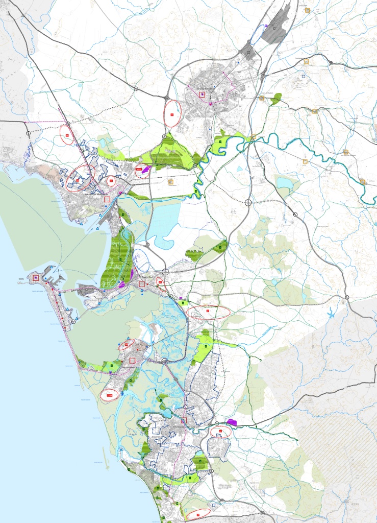
Bay of Cadiz-Jerez de la Frontera Zoning Plan
Estructura Territorial
Area of Special Reserve for activities: Carajolilla-Sancti Petri
Area of Special Reserve for activities: Carajolilla-Sancti Petri


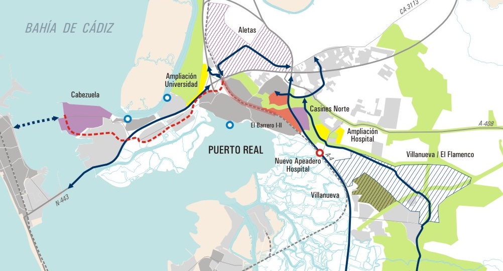
Puerto Real: supramunicipal proposal
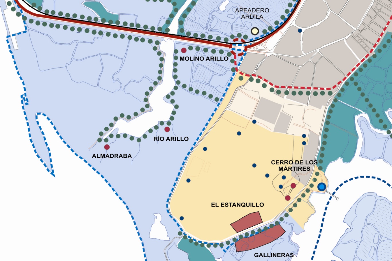
Cultural legacy for the recognition of the territory: Gallineras-Arillo
Cultural legacy for the recognition of the territory: Gallineras-Arillo
-
Situación:
Cádiz - España
-
Superficie:
179.330 Ha
-
Población:
632.000 hab.
-
Realización:
2010-2012
-
Contratante:
Dirección General de Ordenación del Territorio y Urbanismo de La Junta de Andalucía


